Google Maps is a web mapping service developed by Google. It provides satellite imagery, aerial photography, street maps, 360° interactive panoramic view of streets (Google Street View), real-time traffic conditions and route planning pedestrian, auto, bicycle, airway (in beta) and public transport. By 2020, Google Maps was used by more than 1 billion people per month.
Find your way with Google Maps
Step 1: Open the Google Maps app
- For phones, you will open the Google Map application. If you don’t have it on your phone, you can download it from the App Store.

- For computers, open Google Map by following the following link: https://www.google.com/maps
Step 2: Click on the arrow icon on the screen

Step 3: Choose your desired starting point, destination and means of transportation. Right arrow can be selected to change the direction of movement.
Then, the directions interface of Google Maps will display: different routes, means of transport, time.
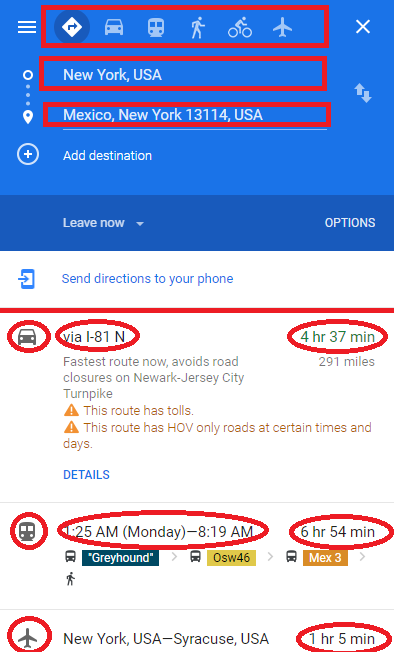
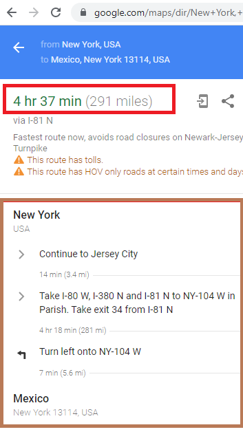
Choose the path you see fit.
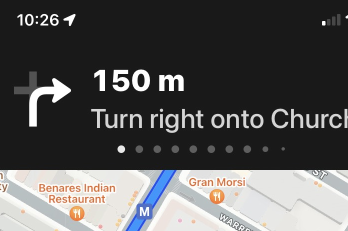
For phones, select “Go”. Then, the guide interface will appear, you just need to follow the instructions of Google Maps to be able to get to the place you want.
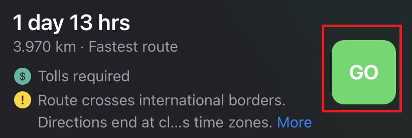
Google Maps navigation interface.
Measure distance between places with Google Maps
Two people who love each other in the same city, want to measure how far from your house to hers Google Maps will help you. Note, this is a straight-line distance, in fact you may have to go further to get to her house. Come on, let’s measure the distance with Google Maps!
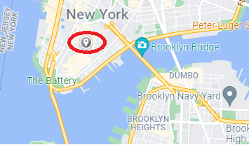
Step 1: Long press on the starting point to drop the pin, at the location where you want to measure the distance on Google Maps.
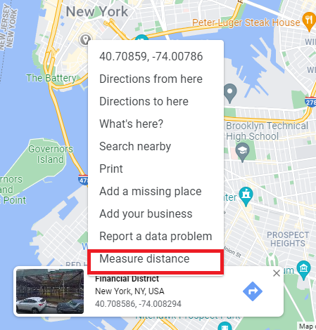
Step 2: Right click on the selected location, select “Measure distance”.
Step 3: Left click on the second place where you need to measure the distance.
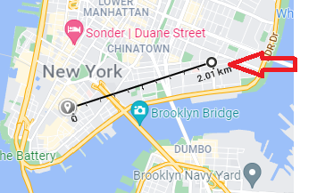
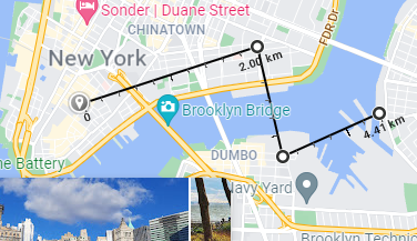
So you have measured the distance between any two points on Google Maps. Have fun with this feature!
Make Google Maps more efficient for others!
Users can earn points by contributing to Google Maps. These are also called Local Guides, are people who discover new places, they write reviews, share photos, answer questions, add or edit places, and check facts on Google Maps. Today, billions of people rely on Local Guides user contributions to decide where to go and what to do. How to accumulate points to become Local Guides as follows:
For phones, you need to first start up Google’s Google Maps app, then select “Contribute” at the bottom of the screen.
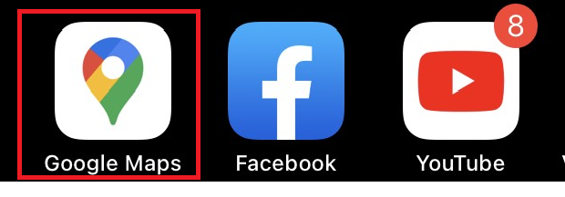

The interface of Google Maps will appear, select “Edit Map”, “Add Place”, “Write Review”, “Add Photo” depending on your purpose.
On your computer, select the location you want to review.
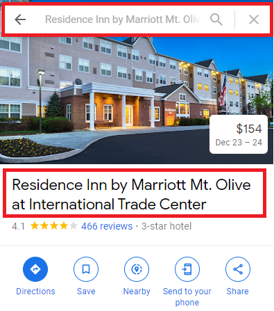
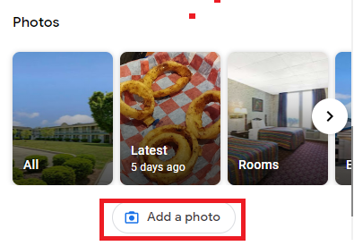

Add your review of the place you just experienced. Note that your reviews are valuable experiences for the community, helping people make better choices.
Use Plus Code to share location on Google Maps
Using Plus Code to share location on Google Maps Plus Code, also known as plus code, is a form of location based on latitude and longitude, works similar to street addresses, plus codes are especially useful for areas There is no specific address.
Step 1: You need to open the Google Maps app on your phone or on your computer.
Step 2: Select the location to share the Plus Code.
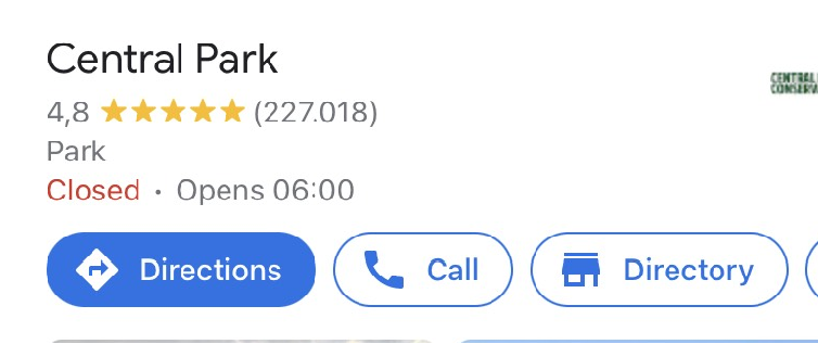
Step 3: Scroll down, select copy Plus Code
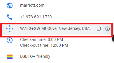
You can paste and send this code to your loved ones, friends or share the code to the relief team when you are in danger.
The article has guided the most basic features of Google Maps, there are many features of Google Maps that need to be discovered by you.
We have tried to provide the most detailed instructions in the hope of helping the best we can. If you have any further questions, feel free to contact us!

